Contents
Index
Recalc Parcel Lines
This option will recalculate parcel dimensions from the job coordinates.
There is also an option to get dimensions from adjacent lines.
If the adjacent lines option is selected, the process for each line will be as follows:
First, search for a matching line in the closed part of a parcel.
If that fails, search for a matching line in one of the connections attached to a parcel.
If that also fails and there are line points on the line, search for matching lines for the line point segments.
If a match is found for every one of the segments, sum them to get the line distance and calculate the bearing from the coordinates of the end points.
If none of the above processes is successful, calculate the bearing and distance from the coordinates of the end points.
To include this Tool in Geocadastre, there has to be an entry in the MenuColumn section of the Config file.
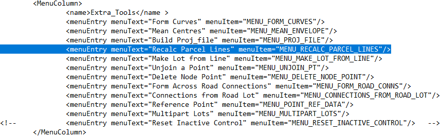
The change to the config file can be made using a text editor.
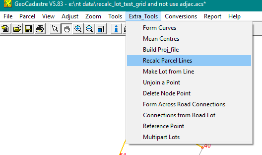
Running the process
Select the tool from the "Extra Tools" list.
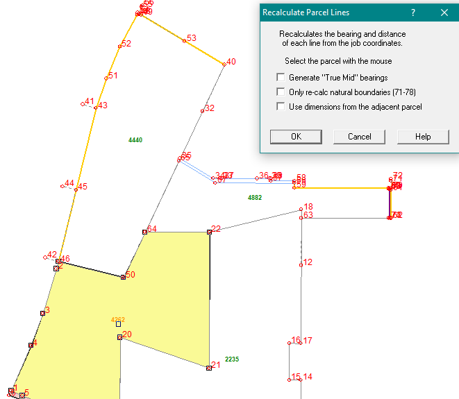
Tick the selected options:
If you require that the computed bearings are to be "True Mid Bearings" tick the first box.
If only the natural boundaries in the lot are to be changed, tick the second box.
If if you wish to adopt dimensions from abutting lines in an adjacent parcels, tick the third box.
After chosing the options, select each parcel with the mouse and hit the OK button.
A menu will pop up to confirm that you have selected the correct parcel.
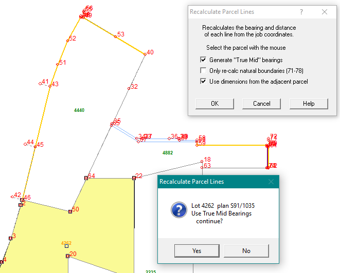
When you hit the "YES" button the lot dimensions will be converted and the parcel misclose will be displayed
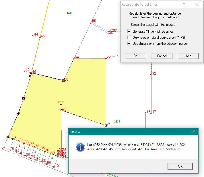
When you hit "OK" on that dialogue box you are ready to either select another parcel or cancel the tool.